Groundwater level measurements with LoRaWAN sensors
Real-time monitoring of groundwater levels with pressure transducer over LoRaWAN
So, what is a ground water level measurement?
A measurement of the water level below land surface in a well.
Static (non-pumping) ground water level measurements represent conditions in the surrounding aquifer.
Measurements over time give a better representation of aquifer conditions
Why monitor groundwater levels?
Groundwater level, as measured in an observation borehole, reflects the amount of water in storage in the monitored aquifer. When recharge exceeds natural discharge plus abstraction, groundwater levels rise.
When recharge is less than natural discharge plus abstraction, groundwater levels fall.
Comparisons of measured groundwater levels with long-term averages provide an indication of the state of groundwater resources within an aquifer. Observation over several years allows the prediction of aquifer response to current climatic and hydrological conditions.
Collected data is used to prepare reports such as the monthly hydrological summaries, annual summaries and the statistics volume. The data are used for quantitative analyses, for instance of annual recharge, and provide a valuable source of data for the calibration of groundwater models.
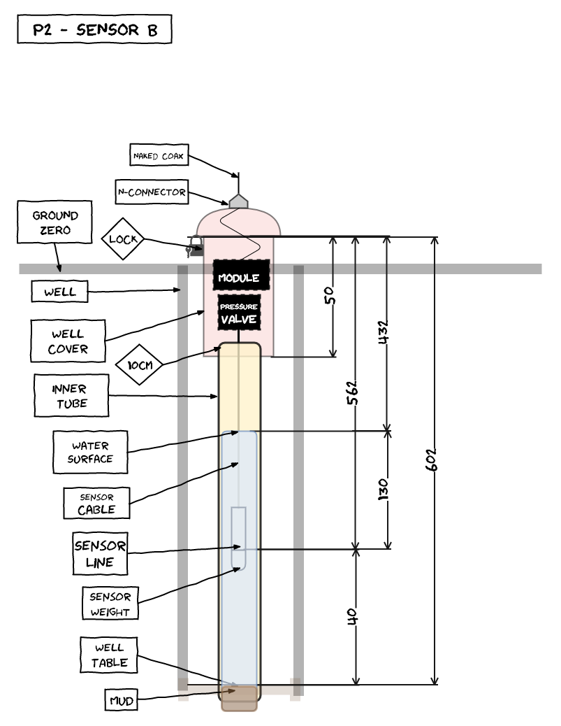
Conventional monitoring processes involve manual collection of data from data recording devices. Sites are usually located in remote locations with no mobile network coverage.
We opted for a real-time data communication over The Things Network LoRaWAN … so engineers could drink their coffee observing the graphs from the office.
Measurements from pressure transducer probe is combined with telemetry data from enclosure in order to monitor the “health” of the node: internal temperature and humidity, anti-tempering sensor and battery status.